ESTB in Maritime, Air and Land applications Jarosław Cydejko, Marek Grzegorzewski, Stanisław...
37
ESTB in Maritime, Air and Land applications Jarosław Cydejko, Marek Grzegorzewski, Stanisław Oszczak, Adam Ciećko EGNOS WORKSHOP EGNOS WORKSHOP , , 24 24 September September 2004 2004 , , Kraków Kraków
Transcript of ESTB in Maritime, Air and Land applications Jarosław Cydejko, Marek Grzegorzewski, Stanisław...
ESTB in Maritime, Air and Land applications
Jarosław Cydejko, Marek Grzegorzewski, Stanisław Oszczak, Adam Ciećko
EGNOS WORKSHOPEGNOS WORKSHOP, , 24 24 SeptemberSeptember 2004 2004, , KrakówKraków
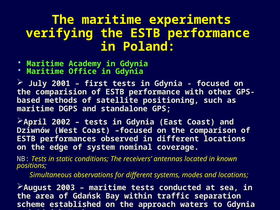
The maritime experiments verifying the The maritime experiments verifying the ESTB performance in Poland:ESTB performance in Poland:
• Maritime Academy in GdyniaMaritime Academy in Gdynia• Maritime Office in GdyniaMaritime Office in Gdynia
July 2001 – first tests in Gdynia - focused on the comparision of July 2001 – first tests in Gdynia - focused on the comparision of ESTB performance with other GPS-based methods of satellite ESTB performance with other GPS-based methods of satellite positioning, such as positioning, such as maritime maritime DGPS and standalone GPS;DGPS and standalone GPS;
April 2002 – tests in Gdynia (East Coast) and Dziwnów (West Coast) –April 2002 – tests in Gdynia (East Coast) and Dziwnów (West Coast) –focused on focused on the comparison of ESTB performances the comparison of ESTB performances observed in different locations on the edge of system observed in different locations on the edge of system nominalnominal coverage. coverage.
NB:NB: Tests in static conditions; The receivers’ antennas located in known positions; Simultaneous observations for different systems, modes and locations;
August 2003 – maritime tests conducted at sea, in the area of Gdańsk August 2003 – maritime tests conducted at sea, in the area of Gdańsk Bay within traffic separation scheme established on the approach waters Bay within traffic separation scheme established on the approach waters to Gdynia and Gdańsk Harbours.to Gdynia and Gdańsk Harbours.
NB:NB: Tests in dynamic conditions, on vessel navigating at sea;
The ESTB position estimations refered to simultaneous RTK GPS observations;
Simultaneous observations for different systems and modes;
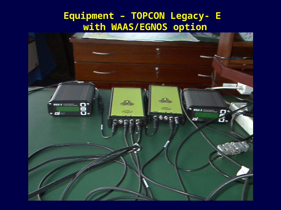
Equipment – TOPCON Legacy- E Equipment – TOPCON Legacy- E with WAAS/EGNOS optionwith WAAS/EGNOS option
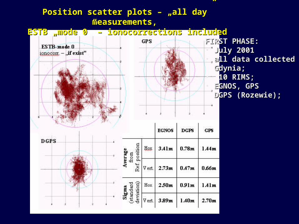
Position scatter plots – „all day” measurements, Position scatter plots – „all day” measurements, ESTB „mode 0” – ionocorrections includedESTB „mode 0” – ionocorrections included
FIRST PHASE:FIRST PHASE:• July 2001 July 2001 • all data collected in all data collected in Gdynia;Gdynia;• 10 RIMS;10 RIMS;• EGNOS, GPSEGNOS, GPS DGPS (Rozewie);DGPS (Rozewie);
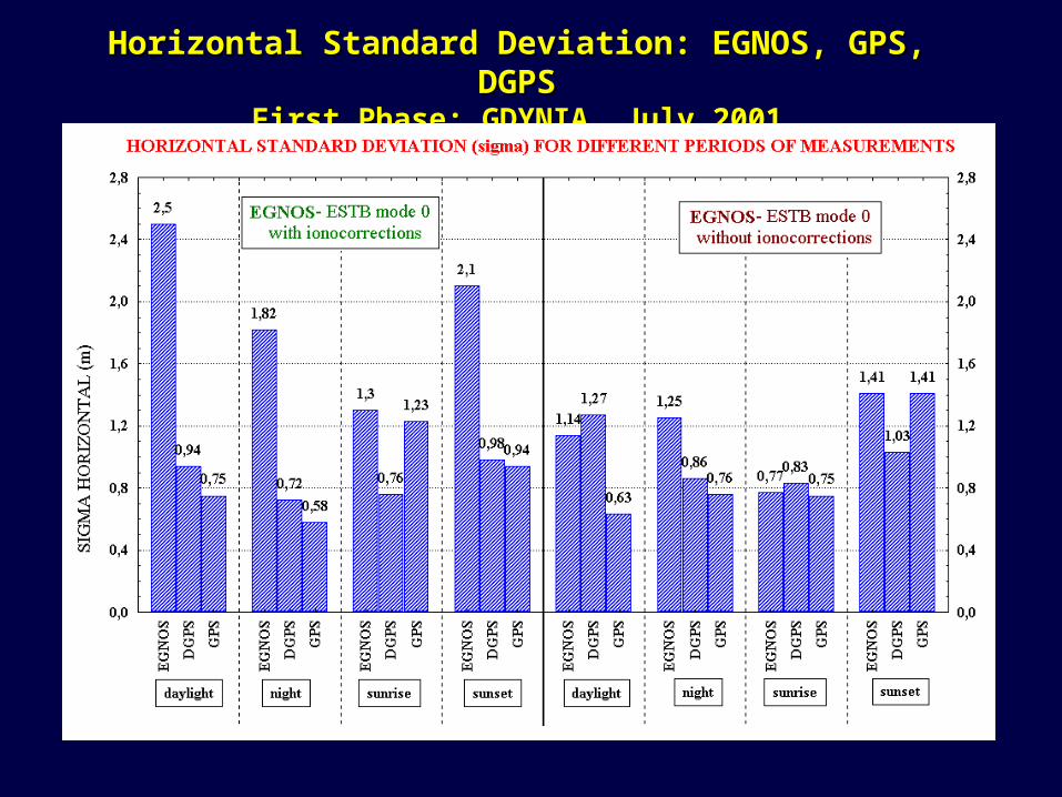
Horizontal Standard Deviation: EGNOS, GPS, DGPSHorizontal Standard Deviation: EGNOS, GPS, DGPSFirst Phase: GDYNIA, July 2001First Phase: GDYNIA, July 2001
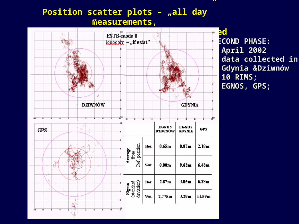
Position scatter plots – „all day” measurements, Position scatter plots – „all day” measurements, ESTB „mode 0” – ionocorrections includedESTB „mode 0” – ionocorrections included
SECOND PHASE:SECOND PHASE:• April 200April 20022 • data collected in data collected in Gdynia &DziwnówGdynia &Dziwnów• 1010 RIMS; RIMS;• EGNOS, GPS;EGNOS, GPS;
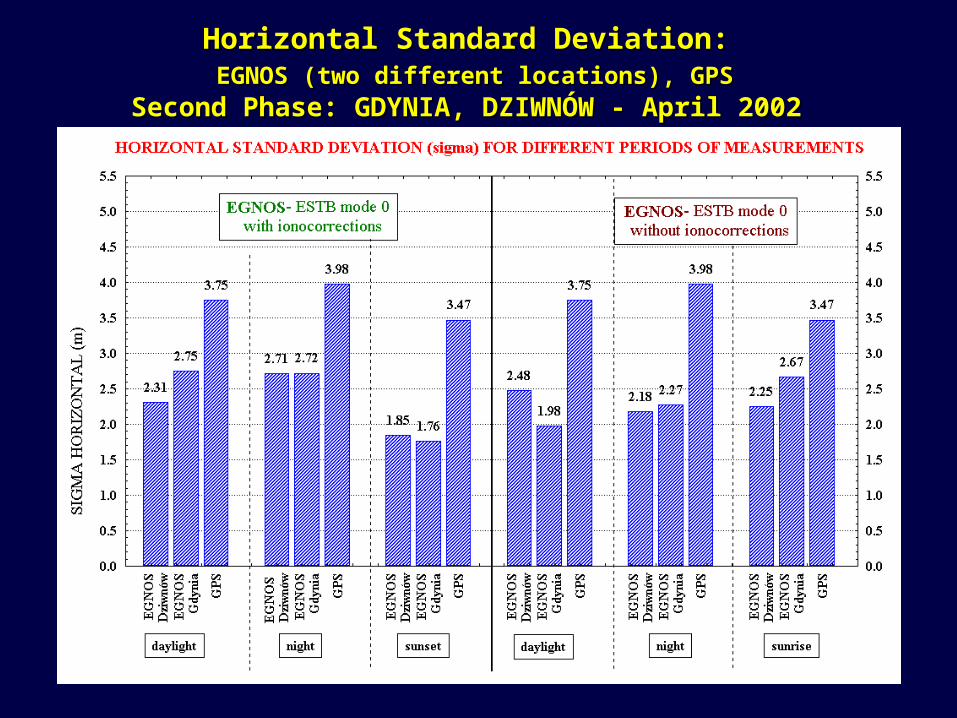
Horizontal Standard Deviation:Horizontal Standard Deviation: EGNOS (two different locations), GPSEGNOS (two different locations), GPS
Second Phase: GDYNIA, DZIWNÓW - April 2002Second Phase: GDYNIA, DZIWNÓW - April 2002
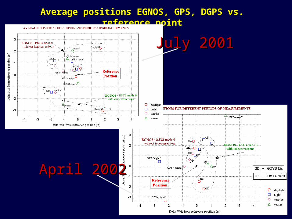
Average positions EGNOS, GPS, DGPS vs. reference pointAverage positions EGNOS, GPS, DGPS vs. reference point
July 2001July 2001
April 2002April 2002
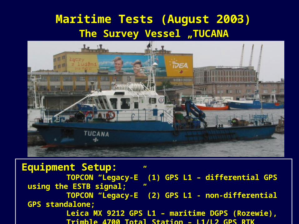
Maritime Tests (August 2003)Maritime Tests (August 2003) The Survey Vessel „TUCANA”The Survey Vessel „TUCANA”
Equipment Setup:Equipment Setup: TOPCON “Legacy-E” (1) GPS L1 – TOPCON “Legacy-E” (1) GPS L1 – differential GPS using the differential GPS using the ESTB ESTB
signal;signal; TOPCON “Legacy-E” (2) GPS L1 - non-differential GPS standalone;TOPCON “Legacy-E” (2) GPS L1 - non-differential GPS standalone; Leica MX 9212 GPS L1 – Leica MX 9212 GPS L1 – maritime DGPS (Rozewie)maritime DGPS (Rozewie),, Trimble 4700 Total Station – L1/L2 GPS RTK receiver. Trimble 4700 Total Station – L1/L2 GPS RTK receiver.
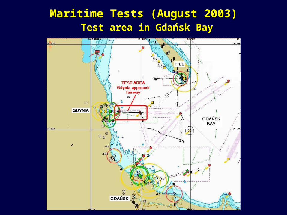
Maritime Tests (August 2003)Maritime Tests (August 2003) Test area in Gdańsk BayTest area in Gdańsk Bay
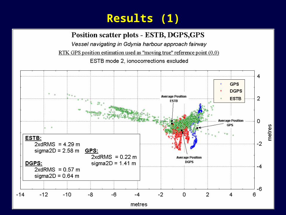
Results (1) Results (1)
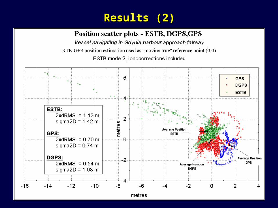
Results (2) Results (2)
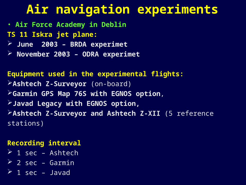
• Air Force Academy in Deblin
TS 11 Iskra jet plane: June 2003 – BRDA experimet November 2003 – ODRA experimet
Equipment used in the experimental flights:Ashtech Z-Surveyor (on-board) Garmin GPS Map 76S with EGNOS option, Javad Legacy with EGNOS option,Ashtech Z-Surveyor and Ashtech Z-XII (5 reference stations)
Recording interval 1 sec – Ashtech 2 sec – Garmin 1 sec – Javad
Air navigation experiments
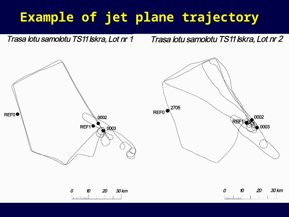
Example of jet plane trajectory
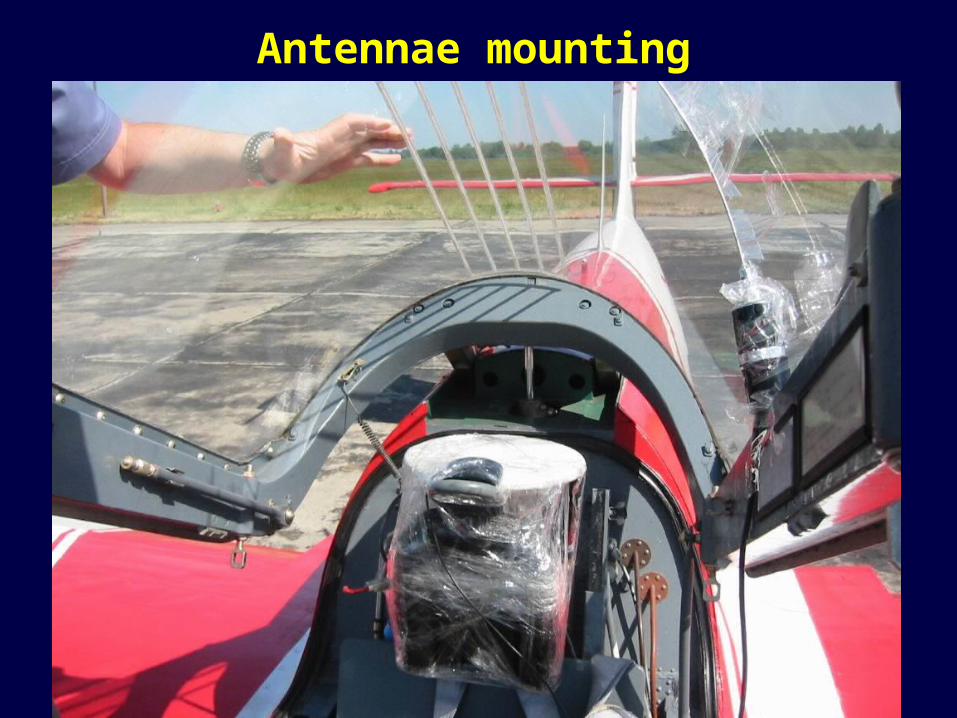
Antennae mounting
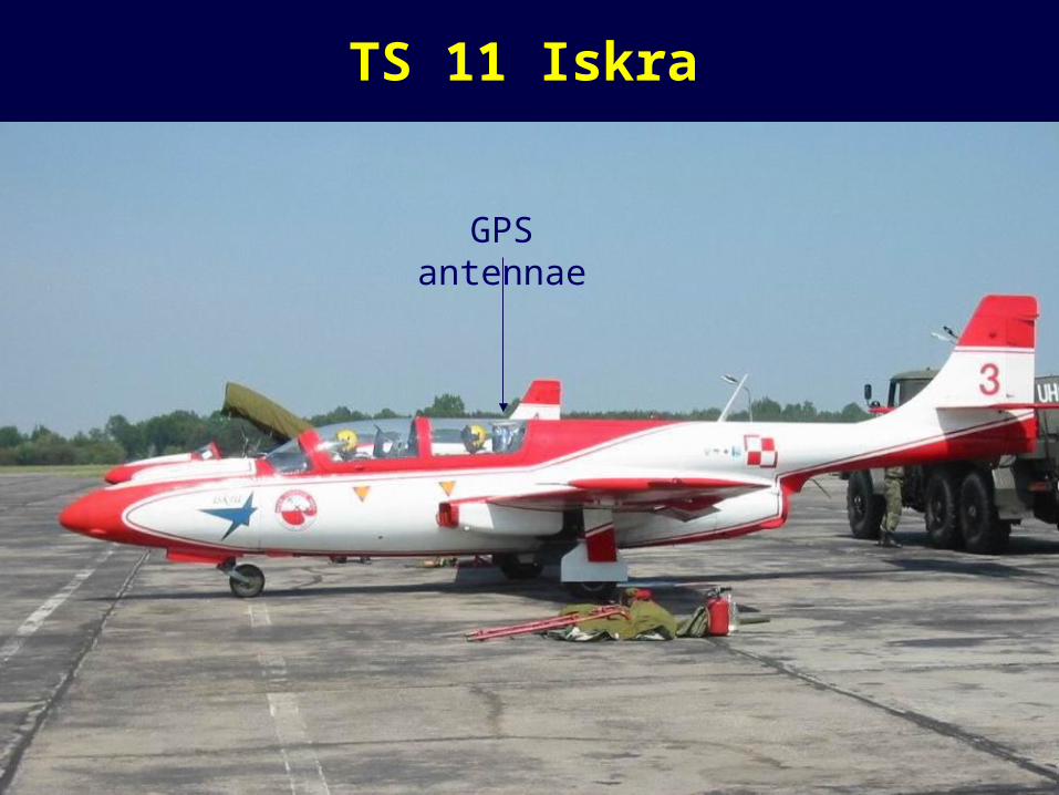
TS 11 Iskra
GPS antennae
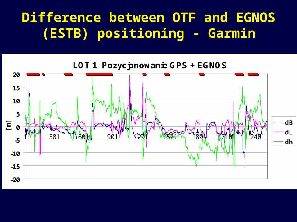
Difference between OTF and EGNOS (ESTB) positioning - Garmin
LOT 1 Pozycjonowanie GPS + EGNOS
-20
-15
-10
-5
0
5
10
15
20
1 301 601 901 1201 1501 1801 2101 2401
[m] dB
dL
dh
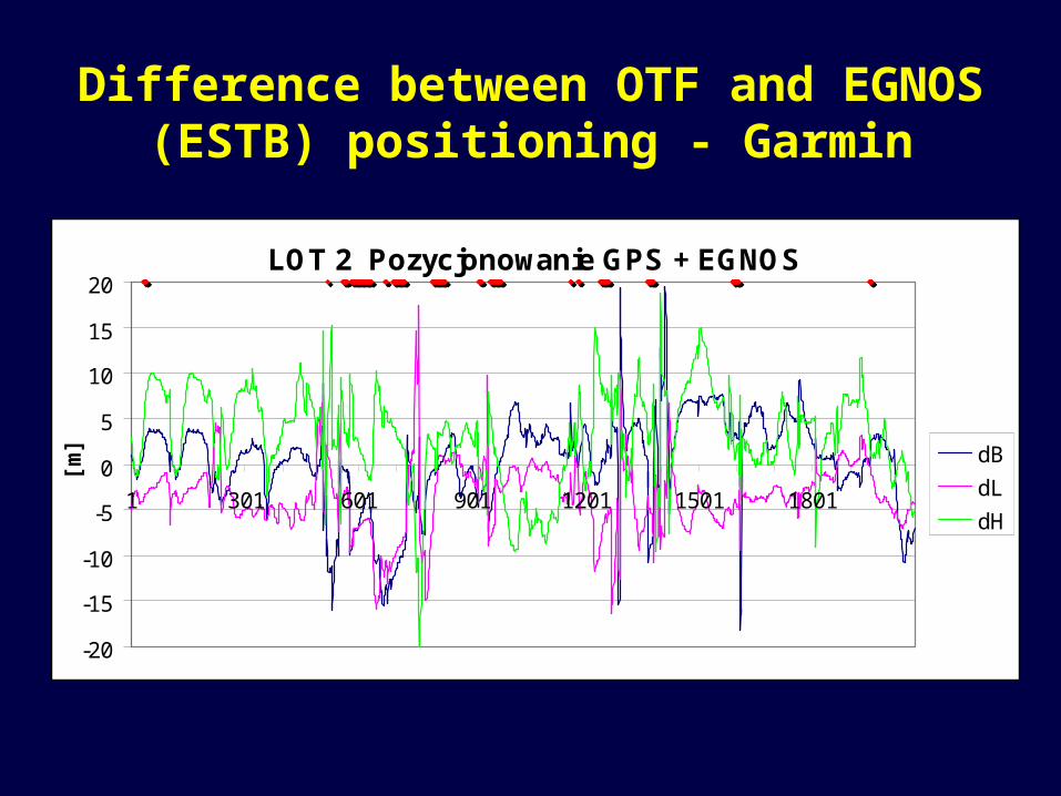
Difference between OTF and EGNOS (ESTB) positioning - Garmin
LOT 2 Pozycjonowanie GPS + EGNOS
-20
-15
-10
-5
0
5
10
15
20
1 301 601 901 1201 1501 1801
[m] dB
dL
dH
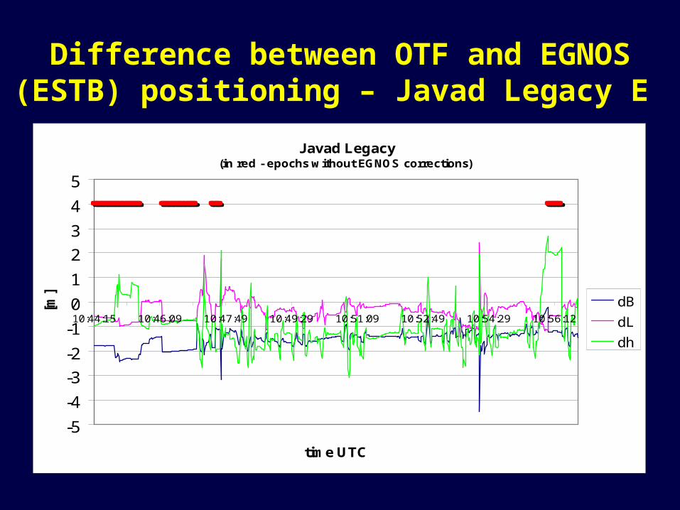
Difference between OTF and EGNOS (ESTB) positioning – Javad Legacy E
Javad Legacy(in red - epochs without EGNOS corrections)
-5
-4
-3
-2
-1
0
1
2
3
4
5
10:44:15 10:46:09 10:47:49 10:49:29 10:51:09 10:52:49 10:54:29 10:56:12
time UTC
[m]
dB
dL
dh
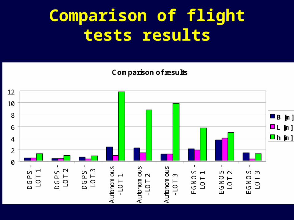
Comparison of flight tests results
Comparison of results
0
2
4
6
8
10
12
DG
PS
-LO
T 1
DG
PS
-LO
T 2
DG
PS
-LO
T 3
Aut
onom
ous
- LO
T 1
Aut
onom
ous
- LO
T 2
Aut
onom
ous
- LO
T 3
EG
NO
S -
LOT
1
EG
NO
S -
LOT
2
EG
NO
S -
LOT
3
B [m]
L [m]
h [m]
Land navigation tests performed in in Central European Countries in 2002Central European Countries in 2002
The main goal of performed trials was the use ESTB signal in satellite based navigation. The authors of the report carried out three experiments across the Central European Countries aiming at data collection during car navigation. The tests were performed in August – September 2002. North-East Poland, East Slovakia and North-East Italy were chosen as test areas. With current allocation of RIMS, the area of Poland and Slovakia is on the eastern edge of the predicted ESTB coverage (Figure 1).
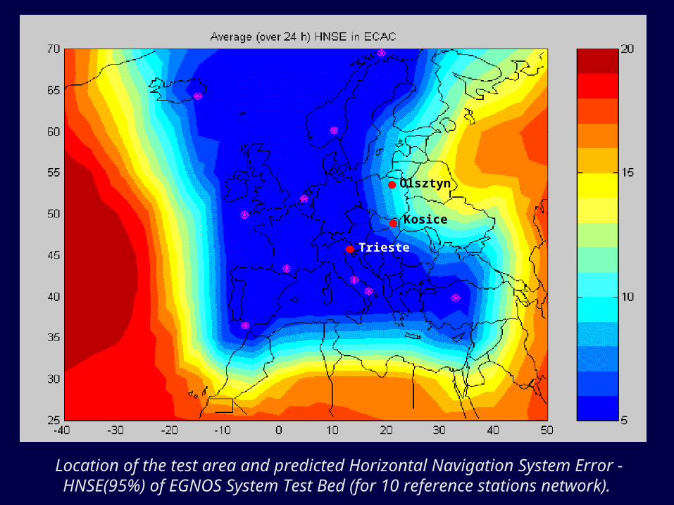
Olsztyn
Kosice
Trieste
Location of the test area and predicted Horizontal Navigation System Error - HNSE(95%) of EGNOS System Test Bed (for 10 reference stations network).
GNSS receivers used in the experiments
2 Ashtech Z-XII geodetic receivers (used for calculation of the OTF car trajectory with one second interval)
2 NovAtel geodetic receivers with EGNOS option of University of Trieste
Magellan Meridian Platinum handheld - the top model of popular Meridian Series, equipped with EGNOS option.
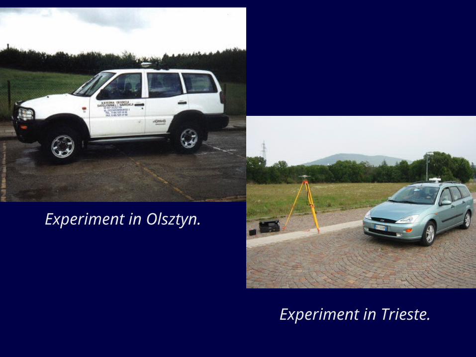
Experiment in Olsztyn.
Experiment in Trieste.
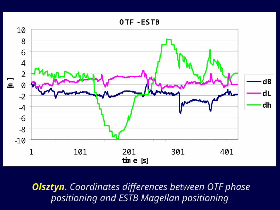
Olsztyn. Coordinates differences between OTF phase positioning and ESTB Magellan positioning
OTF - ESTB
-10
-8
-6-4
-2
0
2
46
8
10
1 101 201 301 401time [s]
[m] dB
dL
dh
OTF - ESTB (Magellan)
-12
-10
-8
-6
-4
-2
0
2
4
1 251 501 751 1001 1251 1501 1751 2001time [s]
[m] dB
dL
dh
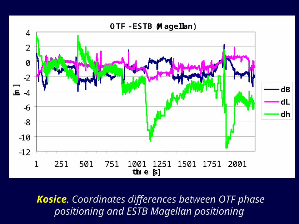
Kosice. Coordinates differences between OTF phase positioning and ESTB Magellan positioning
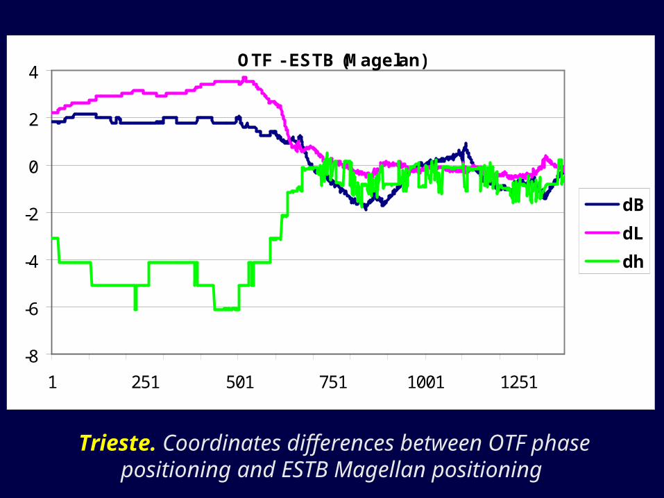
Trieste. Coordinates differences between OTF phase positioning and ESTB Magellan positioning
OTF - ESTB (Magelan)
-8
-6
-4
-2
0
2
4
1 251 501 751 1001 1251
dB
dL
dh
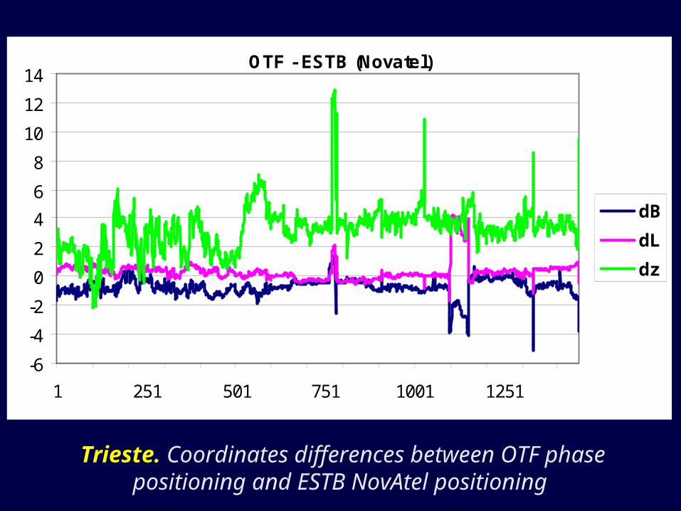
Trieste. Coordinates differences between OTF phase positioning and ESTB NovAtel positioning
OTF - ESTB (Novatel)
-6
-4
-2
0
2
4
6
8
10
12
14
1 251 501 751 1001 1251
dB
dL
dz

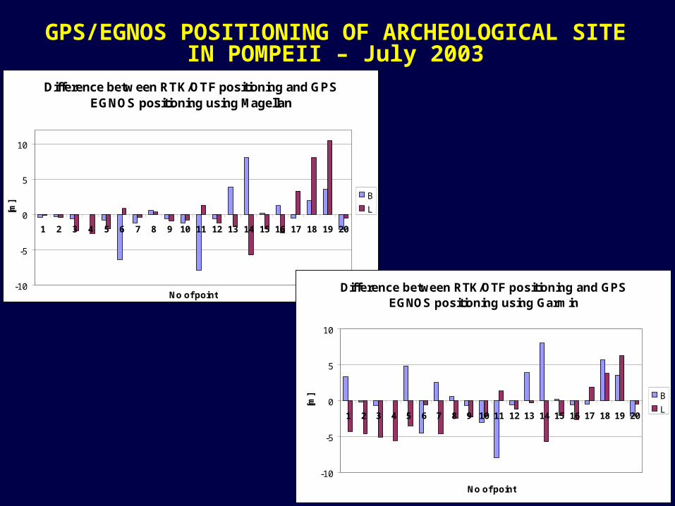
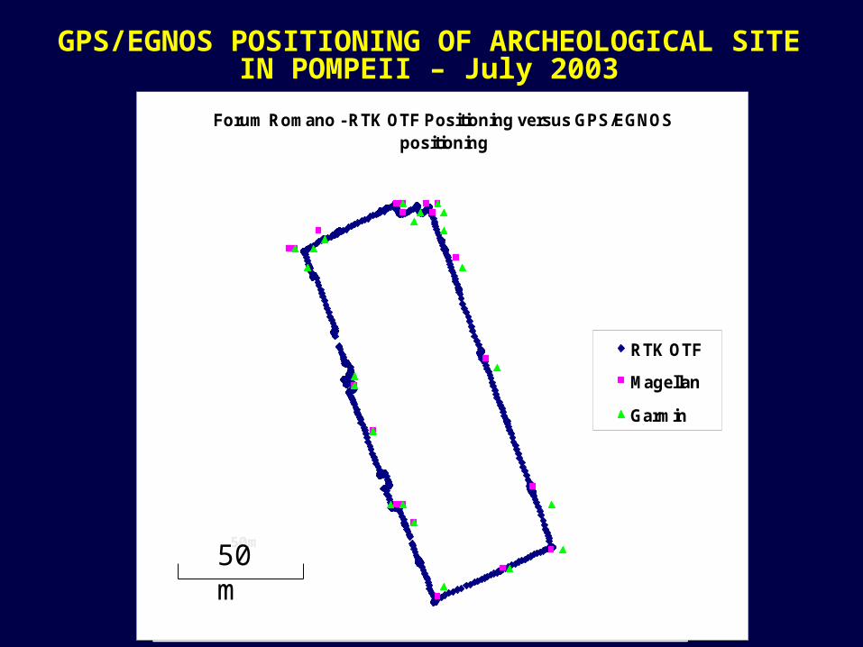
GPS/EGNOS POSITIONING OF ARCHEOLOGICAL SITE IN POMPEII – July 2003
GPS/EGNOS POSITIONING OF ARCHEOLOGICAL SITE IN POMPEII – July 2003
Difference between RTK/OTF positioning and GPS EGNOS positioning using Magellan
-10
-5
0
5
10
1 2 3 4 5 6 7 8 9 10 11 12 13 14 15 16 17 18 19 20
No of point
[m]
B
L
Difference between RTK/OTF positioning and GPS EGNOS positioning using Garmin
-10
-5
0
5
10
1 2 3 4 5 6 7 8 9 10 11 12 13 14 15 16 17 18 19 20
No of point
[m] B
L
GPS/EGNOS POSITIONING OF ARCHEOLOGICAL SITE IN POMPEII – July 2003
50m
Forum Romano - RTK OTF Positioning versus GPS/EGNOS positioning
RTK OTF
Magellan
Garmin
50m50 m
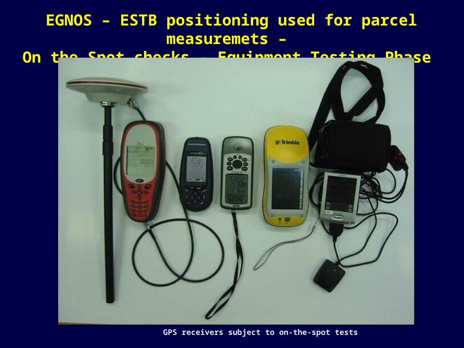
EGNOS – ESTB positioning used for parcel measuremets – On the Spot checks – Equipment Testing Phase
50 m
GPS receivers subject to on-the-spot tests
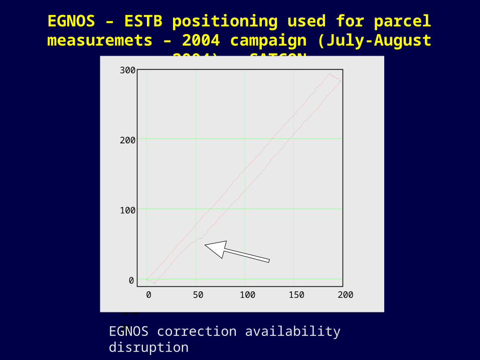
EGNOS – ESTB positioning used for parcel measuremets – 2004 campaign (July-August 2004) – SATCON
50 m0 50 100 150 200
0
100
200
300
EGNOS correction availability disruption
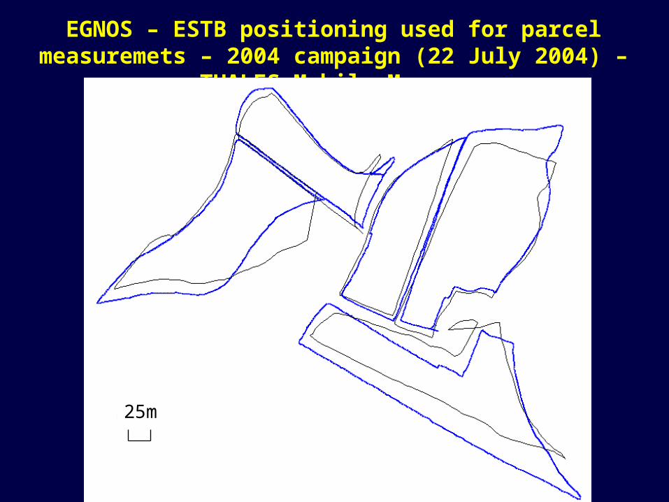
EGNOS – ESTB positioning used for parcel measuremets – 2004 campaign (22 July 2004) – THALES Mobile Mapper
50 m25m
Conclusions
The performed tests show that GPS positioning with the use of ESTB correction gives very promising results. Even better than expected.
The horizontal positioning of moving vehicles with errors around 1-2 meters would be satisfactory for the majority of users of the satellite navigation systems.
Conclusions
Slightly lower accuracy was achieved for vertical coordinate. However the average error of around 3-4 meters without fully operating EGNOS system gives good prognoses for the future.
Some disruptions of ESTB performance were observed giving false results of positioning, therfore Full Operational Capability (FOC) status of the EGNOS system is essential for user. Untill this time ESTB should be used with care.
Thank you for your attention