City of Corsicana C o m p r e h e n s i v e p l a n
8
City of Corsicana Comprehensive plan MESA ECON ITS LAN KENDIG-KEAST June 19, 2007: ADOPTED DATE
Transcript of City of Corsicana C o m p r e h e n s i v e p l a n
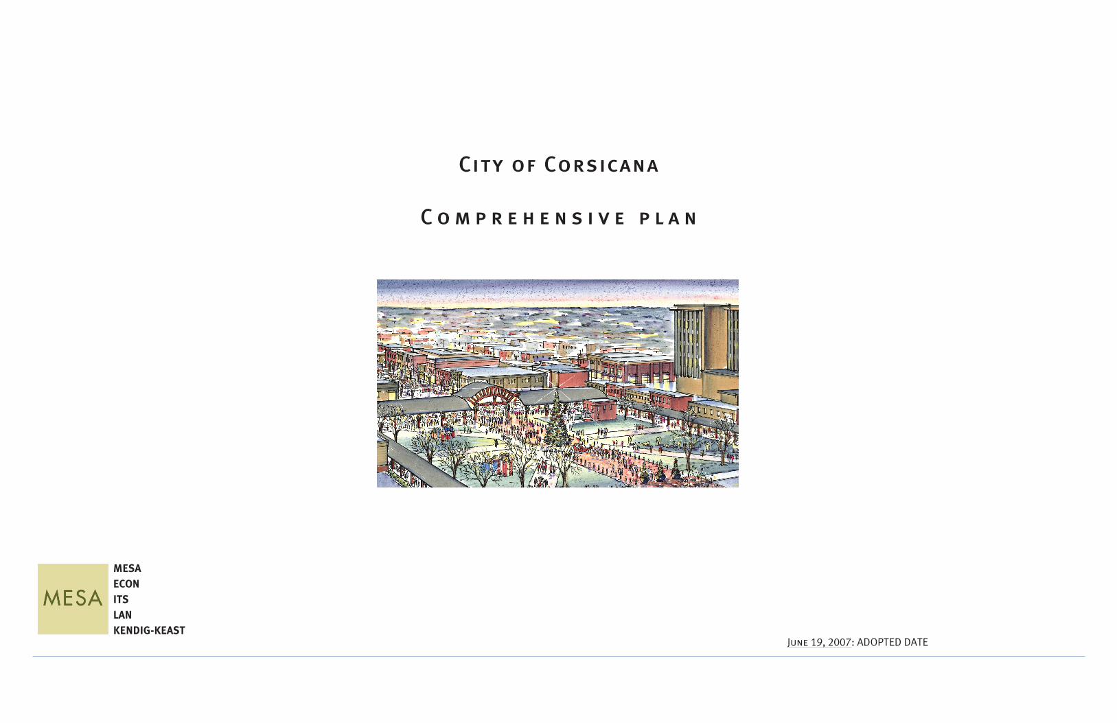
City of Corsicana
C o m p r e h e n s i v e p l a n
MESAECONITSLANKENDIG-KEAST
June 19, 2007: ADOPTED DATE

City of Corsicana, Texas
�

City of Corsicana, Texas
�
ACKNOWLEDGEMENTS
The successful development of the City of Corsicana Comprehensive Plan was made possible by individuals who contributed their time and expertise for the expressed purpose of making Corsicana a better community for future generations. The City of Corsicana would like to express its appreciation to those individuals and groups who provided invaluable time, input and assistance toward this community effort.
Citizens of Corsicana
Navarro Community Foundation
J. Tom Eady Charitable Trust
Bank of America
Katherine C. Carmody TrustJ. N. & Macie Edens Foundation
Perry D. Graham Charitable TrustAnnie Lee Robbins Charitable Trust
Corsicana City Council
Mayor C. L. Brown, IIICity Council
George Walker, Mayor Pro-TemRusty Hitt
Chuck McClanahanRuby Williams
Connie Standridge, City ManagerTerry Jacobson, City Attorney
Corsicana Planning & Zoning
Community Facilitators
Leah BlackardElonda CassadyTommy EskindTerry FaubleSusan HaleBrad Haynie
Jerry JacksonElizabeth Kingman
Les LeskovenJason ManningFrank Martinez
Dan McCoyLou Nagy
Karl PlattWarner RedusB. F. Risinger
Bruce RobinsonEllen Robinson
Tim StitesPatti Taylor
Scott Watkins
Corsicana City Staff
Sharla Allen, Parks & RecreationElizabeth Borstad, City Engineer
Police Chief G. M. Cox Wendy Huffman, Tourism & Promotions
Ron Lynch, Public WorksLee McCleary, Economic Development
Cathy McMullan, City SecretaryFire Chief Donald McMullan
Larry Murray, Environmental ServicesMalinda Payne Sharpley, Main Street Program
Pat Spiller, Public LibraryLowell Thompson, Municipal JudgeSherri Warren, Planning & Zoning

City of Corsicana, Texas
�
Facilities
Corsicana Area Chamber of CommerceCorsicana Independent School District
Corsicana Public Library
Planning Consultant Team
MESAECON
ITSLAN
KENDIG-KEAST

City of Corsicana, Texas TABLE OF CONTENTS
�
TABLE OF CONTENTS
1. INTRODUCTION…………………………………………………………..........................7
PART ONE: THE ASSESSMENTS
2. FORM ANALYSIS…………………………………………………….…..........................9
FORM DISTRICTS MAP.......................................................................11A. DISTRICT ONE: THE DOWNTOWN DISTRICT……………...........12B. DISTRICT TWO: THE DOWNTOWN TRANSITION DISTRICT……………………………………...............15C. DISTRICT THREE: THE EAST COMMUNITY DISTRICT…….........16D. DISTRICT FOUR: THE SOUTHERN COMMUNITY
DISTRICT…………………………………...............…18 E. DISTRICT FIVE: THE WESTERN COMMUNITY DISTRICT……………………………………...............20 F. DISTRICT SIX: THE NORTHERN COMMUNITY DISTRICT……………………………………...............22 G. DISTRICT SEVEN: THE RAIL/CREEK COMMUNITY DISTRICT………………..........….......................24 H. DISTRICT EIGHT: THE NAVARRO DISTRICT…………..........……..26 I. DISTRICT NINE: THE LAKE HALBERT DISTRICT………............27
3. ECONOMIC BASE ANALYSIS…………………………………............................28
A. PROXIMITY………………………………………………………….........................29B. PLACE………………………………………………………………….........................31C. PURPOSE………………………………………………………………......................32
4. SYSTEMS ANALYSIS…………………………………………………........................35
A. ROADWAYS…………………………………………………………........................35B. DRAINAGE…………………………………………………………….......................35C. WATER………………………………………………………………….......................36D. WASTEWATER………………………………………………………......................37
PART TWO: THE PLANNING PROCESS
5. THE CITIZEN PROCESS……………………………………………………………...........38
A. WORKSHOP ONE: GOALS AND OBJECTIVES…………………..............38B. WORKSHOP TWO: ENVISIONING………………………………..................44C. WORKSHOP THREE: PUTTING IT ALL TOGETHER…………...............44
PART THREE: THE COMPREHENSIVE PLAN
6. THE FRAMEWORK PLAN........................................................................................46
A. INTRODUCTION...............................................................................................46B. MATRIX ANALYSIS…………………………………………………….......................................46C. TOP TEN GOALS/TOP TEN ACTIONS……………………………….................................48D. THE FRAMEWORK PLAN...………………………………………........................................49E. CONCLUSION..................................................................................................50F. FRAMEWORK MAP..........................................................................................51
7. THE LAND USE PLAN............................................................................................52
A. INTRODUCTION……………………………………………………….......................................52B. LAND USE PLAN AND ZONING PLAN...............................................................53C. HOLDING CAPACITY FOR PROJECTED POPULATION........................................55
i. SCHOOLS.........………………………………........................................55ii. RETAIL…………………………………………………………............................57iii. EMPLOYMENT RELATED USES………………………..........................57iv. COST IMPLICATIONS OF LAND USE PLAN….…………………………...58
D. COMPARISON WITH THE PREVIOUS LAND USE PLAN………..............................62E. RECOMMENDATIONS……………………………………………….......................................62F. LAND USE DEFINITIONS……………………………………………......................................64G. LAND USE MAP...............................................................................................66
8. THE THOROUGHFARE PLAN.................................................................................67
A. INTRODUCTION...................................……………………......................................67B. PROPOSED LOOPS.........................................................................................67C. KEY COMPONENTS.........................................................................................68
i. INTERCHANGES………………………………........................................68ii. CAPACITY...…………………………………………………............................69iii. RAILROADS..…………………………………………………..........................70iv. ALTERNATIVE TRANSPORTATION............….…………………………...70
D. FUNCTIONAL CLASSIFICATION SYSTEM..........................................................70i. EXPLANATION AND APPLICATION.…........................................70ii. GUIDELINES TABLE.……………………………………............................71
E. TRAFFIC CAPACITIES......................................................................................72i. LEVEL OF SERVICE........................…........................................72
F. KEY GOALS....................................................................................................72G. RECOMMENDATIONS....................................................................................73H. CONCLUSION................................................................................................75 I. TRAFFIC VOLUMES MAP................................................................................76 J. THOROUGHFARE MAP...................................................................................77

City of Corsicana, TexasTABLE OF CONTENTS
�
9. THEOPENSPACEPLAN.........................................................................................79
A. THETRAILNETWORK:INTEGRATINGPEDESTRIAN-ORIENTEDSPACE WITHOPENSPACE..........................................................................................79B. WATERSHEDFEATURES.....................…………………………….................................79C. CONCLUSION.....................……………………………................................................80
10. THEPARKSANDRECREATIONPLAN.....................................................................81
A. PARKREQUIREMENTS..……………………………………………......................................81B. DEVELOPMENTDEDICATIONSTANDARDSFORPARKANDOPENSPACE..........83C. REGIONALPARKRECOMMENDATIONS………………….........................................83
11. THEWATERSHEDPROTECTIONPLAN…………………………….......................................84
A. CORSICANA’SWATERSHED.............................................................................84i. CREEKSANDWATERWAYS.............……………..............................84ii. LAKES......................………………………………..................................86iii. SOILS...........…………………………………………………...........................87iv. ASSOCIATEDHABITATANDDETENTIONFACILITIES..................88
B. WATERSHEDPRESERVATION&RECOMMENDATIONS.....................................88
12. DOWNTOWNREVITALIZATIONPLAN.....................................................................91
A. INTRODUCTION...............................................................................................91B. REVITALIZAIONPLANELEMENTS.....................................................................91
STEP#1:CREATEASIGNIFICANTPUBLICSPACE(THETRADITIONALTEXASCOURTHOUSESQUARE)............................................................................91
STEP#2:CONSOLIDATETHECOMMERCIALFABRIC........................................92STEP#3:CONSOLIDATETHEGOVERNMENTALINSTITUTIONALFABRIC..........93STEP#4:CREATEACENTRALREFUGEFORTHEDOWNTOWNCOREANDA
MAJORPUBLICGATHERINGSPACE............................................................94STEP#5:CREATEAMORECONCENTRATEDAREAOFIMPACTREINFORCEDBY
PUBLICLINKAGES......................................................................................94STEP#6:CREATEACONNECTIONTO,ANDANAPPROACHFROM, INTERSTATE45..........................................................................................95STEP#7:ESTABLISHADOWNTOWNPLAZADISTRICTTHATPROVIDES
AREGULATORYSTRUCTUREFORTHEAPPLICATIONOFPUBLIC/PRIVATESTREETSCAPE,STREETINTERFACE,ANDARCHITECTURALGUIDELINES...............................................................................................95
STEP#8:ESTABLISHAMANAGEMENTSTRUCTUREFORTHEDOWNTOWNPLAZA........................................................................................................96
STEP#9:BRINGTOGETHERTHEPROPERELEMENTSOFPLAZAANDDISTRICTDESIGN......................................................................................................96
C. DOWNTOWNREVITALIZATIONMAP...........................................................97D. DOWNTOWNREVITALIZATIONVISIONRENDERING....................................98
13. DOWNTOWNDESIGNGUIDELINES..................................................................99
A. DISTRICTA:COMMERCIALFRONTAGEZONE..............................................99 i. STATEMENTOFPURPOSE..............................................................99
ii. STREETSCAPEGUIDELINES............................................................99 iii. STREETSCAPEINTERFACEGUIDELINES........................................104 iv. ARCHITECTURALGUIDELINES......................................................105
B. GOVERMENTALFRONTAGEZONE............................................................108 i. STATEMENTOFPURPOSE............................................................108 ii. STREETSCAPEGUIDELINES..........................................................108 iii. STREETSCAPEINTERFACEGUIDELINES........................................112 iv. ARCHITECTURALGUIDELINES......................................................113 C. DISTRICTSUPPORTZONE.......................................................................114
i. STATEMENTOFPURPOSE............................................................114 ii. STREETSCAPEGUIDELINES..........................................................114 iii. STREETSCAPEINTERFACEGUIDELINES........................................115 iv. ARCHITECTURALGUIDELINES......................................................116
14. APPENDICES.................................................................................................119
APPENDIXAPLANTPALLETTE.…………………….................................................119 APPENDIXBSTREETFURNITURE,FIXTURESANDHARDWARE.......................121 APPENDIXCDESIGNCONCEPT-FARMERSMARKETSTRUCTURE..................125 APPENDIXDDOWNTOWNPLAZADISTRICTOVERLAY SAMPLEORDINANCE....................................................................127
City of Corsicana, Texas INTRODUCTION
�
Introduction
Purpose Statement
The City of Corsicana hired MESA Design Associates in August of 2005 to formulate a Comprehensive Plan for its corporate land area and the associated extra territorial jurisdiction. Given a total land area of approximately 37,216 acres, the Comprehensive Plan necessitates a long-range vision that anticipates a built-out condition. Though build-out of the entire 37,216 acres is unlikely to occur in any reasonable Comprehensive Planning time-frame, build-out nevertheless becomes the reference point for this Comprehensive Planning activity due to the scope of the Comprehensive Plan itself. Assuming it is possible to sustain the projected growth rates for Corsicana (see discussion of growth rates in the Land Use Plan section of this report) and eliminate infrastructure limitations (such as water), then Corsicana’s city limits plus its extra territorial jurisdiction could hold 327,000 people. The build-out population for just the city limits would be 76,128.
The reference to the build-out (interchangeably called holding capacity in this report) is intended for the use of City Staff, City Council, other decision-makers, and citizens as they direct and influence the physical growth and development of the Community. Therefore, this Comprehensive Plan establishes a generalized pattern of land use and thoroughfares. It also recommends strategies of action required to implement the elements of vision contained in this document. The Comprehensive Plan is a management tool that will provide a valuable reference in the decision-making process of municipal governance. For this reason, the recommendations of the Comprehensive Plan are supported by resident and property-owner generated goals and objectives which root the Comprehensive Plan and the vision it articulates in the aspirations and concerns of the people who will live and work in the City it influences.
This Comprehensive Plan is a reflection of community sentiments, aspirations, goals, objectives, and vision. Community direction has been transformed into a graphic representation of that direction (Framework Comprehensive Plan). The Framework Comprehensive Plan is used to create maps, diagrams, text, and vision designs that establish policies to address the many issues now facing Corsicana and influencing its response to the future. As a result, this Comprehensive Plan becomes a “management tool” for addressing current and future growth and initiating change that will move Corsicana toward the quality of life desired by its residents.
The Comprehensive Plan will become the official policy of the City of Corsicana and guide its decisions regarding development and capital expenditure. (The Comprehensive Plan is a guide and should not be construed as a rigid code.) The Comprehensive Plan anticipates an on-going process that will, in time, necessitate another reassessment and update.
Corsicana Master Planning History
The last Comprehensive Plan for the City of Corsicana was prepared in 1982 by Kindle Stone
& Associates, Incorporated (Engineers and Planners). The 1982 Comprehensive Plan is an update of the earlier 1971 Comprehensive Plan prepared by the noted planner, Marvin Springer. When the 1971 Comprehensive Plan was written, Corsicana had a population of 20,500 people. That population had only increased to 21,712 people by 1980. Since then, Corsicana has addressed its need for comprehensive views of infrastructure and land use by relying upon the City Staff to prepare graphic representations of the City’s evolving thoroughfare system and zoning patterns. These documents were prepared as an interim measure intended to facilitate decisions facing the City leadership.
Today, Corsicana’s population remains relatively stable at 26,014. However, both the 1971 Comprehensive Plan and the 1982 update make relatively aggressive projections to the year 2000. The 1982 Comprehensive Plan projects a year 2000 population of slightly less than 40,000 (based on a 3% growth rate) and the 1991 Comprehensive Plan projects a 1990 population of 30,000. While the growth rate remains relatively flat between 1971 and 1982, both Comprehensive Plans take an aggressive posture toward the future and base their population projections on an increased growth rate. These former Comprehensive Plans and the Comprehensive Plan presented in this document are similar in that regard. However, the basis of an increased growth rate in earlier Comprehensive Plans does not tie that increase to growth dynamics of sufficient power to merit such a conclusion. By contrast, this Comprehensive Plan bases its assumptions on the general consensus regarding the growth of Dallas/Ft. Worth and endeavors to regionalize this growth picture to a scale that includes Corsicana. This methodology puts the 20-year (2026) growth projection at 43,301, a magnitude of increase not unlike that projected in the earlier Comprehensive Plans.
The intents of the earlier Comprehensive Plans do not greatly differ from those set forth in this Comprehensive Plan. While the 1971 Comprehensive Plan did not reach over a land area much beyond the City limit, it identified planning issues that are very similar to those established through public participation in 2006. The 1971 Comprehensive Plan issues include:
• Creating a central business district as a hub for business and economic development.
• Improving thoroughfares:o Highway 45 forms a barrier to the east side of Corsicana.o The irregular character of some streets results in local streets terminating,
lacking continuity, and generally not being desirable for the routing of major thoroughfares.
o The railroad facilities (crossings) have brought about termination of local streets and/or interrupted its continuity. Thought should be given to grade separation of crossings.
• Land Use:o Twenty-five percent of the developed land area is non-residential (or 12.4% of
the total land area; 49% of the total land area is developed).
With a similar focus, the 1982 Comprehensive Plan issues include:

City of Corsicana, TexasINTRODUCTION
�
• Thoroughfares
o Take necessary steps to determine the most suitable and cost-effective location for construction of a major railroad grade separation.
o Provide street standards capable of carrying future traffic volumes.o Railroad separations between the majority of residential areas from principal
workplaces must be addressed.o Major grade separations (separating vehicle from rail) must be a part of any
future thoroughfare plan.
• Land Use
o Retail and commercial uses are heavily concentrated in strip retail configurations (reflecting nation-wide trends) and competing with the downtown area.
The most striking comparison between this Comprehensive Plan and the 1971 Comprehensive Plan is in the area of thoroughfares (see Thoroughfare Map on page 86). Marvin Springer fashioned a thoroughfare system design that sought to overcome the constrictions of Corsicana’s aging and inflexible grid with a series of loops that provided points of relief (ingress/ egress) around the edges of the grid. This approach was very forward-looking in that it also maintained a value gradient (relationship of land values created by traffic corridors) that centered on, and was otherwise set in, relationship to the historic Downtown Core.
In addition, the 1971 Comprehensive Plan foresaw the importance of pushing east/west arterials out to Interstate 45 and making continuous north/ south arterials that connected with the proposed loops. Likewise, this Comprehensive Plan extends east/west arterials out to Interstate 45 and beyond to the eastern segments of the “Inner Loop” (as defined in the 2007 Comprehensive Plan). Also, this Comprehensive Plan created a series of north/ south arterial continuities (using couplets and existing, wide right-of-ways) out to relief points along the Inner Loop and the southern Texas Department of Transportation (TXDOT) Loop Bypass.
The result of these similar thoroughfare initiatives is a thoroughfare Comprehensive Plan that has many shared qualities. However, this Comprehensive Plan gives more attention to movement within the Downtown Core. It seeks to create a concentration of traffic movement within the Downtown Core (rather than alongside it) so that the Downtown Core realizes the value created by traffic movement and thereby is more attractive to investment. This Comprehensive Plan also creates significantly more traffic capacity within the industrial areas south of the Downtown Core so these areas are capable of accommodating the traffic volumes that can be potentially imposed by the land area already zoned for industrial/ commercial use.
While the issues defined in 1971 and 1982 bear a similarity to those set forth in 2006, the response to those issues vary. The current growing conflict between development trends now manifest in the city and the community’s aspirations moved the Corsicana City Council
to embark upon a new Comprehensive Plan in the fall of 2005. The Comprehensive Plan desired by Council was one that differed from the 1971 and 1982 Comprehensive Plans and various interim measures in the following ways:
• Create a revitalization of the historic downtown business core.• Specifically address the need to improve employment and wages. • Resolve traffic congestion problems that are depreciating the attractiveness of the
downtown core.• Maximize the inherent historic qualities of Corsicana as a basis for future growth.• Envision a better-balanced and physically-coherent City.• Incorporate a methodologically sound, broad, and inclusive process of citizen
involvement that will guide the Comprehensive Plan and its recommendations.• Recognize and protect the unique qualities of Corsicana that are threatened in the
face of future growth.
These performance requirements imposed at the outset of Corsicana’s Comprehensive Planning Process meant that the aspect of “Vision” would be essential. It would become necessary for the Comprehensive Planning Team to facilitate public leadership by projecting a possible future build-out and from that vantage look back on the present City to determine the extent to which current development patterns (both public and private) will facilitate or restrict accommodation of growth and development potential. In this way, this Comprehensive Plan will differ from all the Comprehensive Plans that came before it.
While vision was definitely an element of the 1971 Comprehensive Plan, the distant reality of significant growth did not require that such vision be specifically translated into Comprehensive Plans that addressed the “potential growth sphere” that would draw upon (and influence) the resources of the City of Corsicana. By contrast, the “Potential Growth Sphere” now includes portions of Richland Chambers Lake (Limestone County) and Ellis. In addition, the 1971 reality of a small population and/ or the lack of urgent need for interim infrastructure/ land use Comprehensive Plans meant that broad and inclusive citizen participation was not as necessary as it is today. Therefore, the 2007 Comprehensive Plan will be a citizen-influenced document that seeks to give form to the City’s goals and translate that form into the physical plans and strategies contained herein. These documents, and the supporting research accompanying them, will give the City Council sufficient knowledge to address aspects of dramatic change now imposed by a gathering future demand for housing, shopping, employment, recreation, and municipal services.
The Comprehensive Planning Process
The 2007 Comprehensive Plan described in the following text is presented as it was developed in conjunction with continuous resident and property owner involvement over a period of one year. This patient process and the efforts made to make certain that all stakeholders were heard is unique and reflects a City leadership that is determined to see that Corsicana benefits from the economic reality of growth without loosing those aspects of heart and soul that make Corsicana truly different.