Seismic observatory at Arctow- ski's ... - polish.polar.pan.pl · 122 Tadeusz Jace Kowalskk i There...
12
POLISH POLAR RESEARCH (POL. POLAR RES.) 117—128 1980 POLSKIE BADANIA POLARNE 117—128 1980 Tadeusz Jacek KOWALSKI Department of Polar and Marine Research, Institute of Geophysics, Polish Academy of Sciences, Warsaw Seismic observatory at Arctow- ski's Station (King George Is- land, South Shetland Islands) *) ABSTRACT: The paper informs about a foundation of seismic observatory at Arctowski's Station in the beginning og 1978. Descriptions of the object and of registration seismic instruments are included. Conditions of registration and parameters of instruments are noted. Registration sequence of seismic tremors from March 1978 to October 1979 is described. A preliminary statistics of tremors is also announced. Key words: Antarctic, seismic observatory 1. Introduction South Shetlands, localized at the end of an arc of islands and submarine ridges that delimit the Scotia Sea (Fig. 1), are an interesting area from a geotectonical point of view. Usefulness of a seismic station on King George Island is caused by a very limitted number of stations in this area that register the tremors of the earth's crust and so, collect an unsatisfactory number of information needed for detailed analysis of earth's crust and upper mantle structures and of geodynamic processes that occurred there as the Geodynamics of the Scotia arc is one of principal problems of International Project of Geodynamics. This undertaking tends to concentrate the studies over geodynamic processes and is taken for a complex discuss of earth's inner structure and surface in agreement with generally used and accepted hypothesis of plate tectonics. The seismic station (lat. S 62°09'33", long. E 58°27'45") is located near Arctowski Station of Polish Academy of Sciences (King George Island, South Shetland Islands). *) Foundation of seismic observatory at Arctowski Station had place during the Second Antarctic Expedition (1977/78) organized by Polish Academy of Sciences (Institute of Geophysics).
Transcript of Seismic observatory at Arctow- ski's ... - polish.polar.pan.pl · 122 Tadeusz Jace Kowalskk i There...
POLISH POLAR RESEARCH (POL. POLAR RES.) 117—128 1980 POLSKIE BADANIA POLARNE 117—128 1980
Tadeusz Jacek K O W A L S K I Department of Polar and Marine Research, Institute of Geophysics, Polish Academy of Sciences, Warsaw
Seismic observatory at Arctow-ski's Station (King George Is-land, South Shetland Islands) *)
A B S T R A C T : The paper informs about a foundation of seismic observatory at Arctowski's Station in the beginning og 1978. Descriptions of the object and of registration seismic instruments are included. Conditions of registration and parameters of instruments are noted. Registration sequence of seismic tremors from March 1978 to October 1979 is described. A preliminary statistics of tremors is also announced.
K e y w o r d s : Antarctic, seismic observatory
1. Introduction
South Shetlands, localized at the end of an arc of islands and submarine ridges that delimit the Scotia Sea (Fig. 1), are an interesting area from a geotectonical point of view. Usefulness of a seismic station on King George Island is caused by a very limitted number of stations in this area that register the tremors of the earth's crust and so, collect an unsatisfactory number of information needed for detailed analysis of earth's crust and upper mantle structures and of geodynamic processes that occurred there as the Geodynamics of the Scotia arc is one of principal problems of International Project of Geodynamics. This undertaking tends to concentrate the studies over geodynamic processes and is taken for a complex discuss of earth's inner structure and surface in agreement with generally used and accepted hypothesis of plate tectonics.
The seismic station (lat. S 62°09'33", long. E 58°27'45") is located near Arctowski Station of Polish Academy of Sciences (King George Island, South Shetland Islands).
*) Foundation of seismic observatory at Arctowski Station had place during the Second Antarctic Expedition (1977/78) organized by Polish Academy of Sciences (Institute of Geophysics).
118 Tadeusz Jacek Kowalski
Fig. 1. Map of Scotia Sea
2. Construction of geophysical observatory
Three objects were to be constructed at the station for these purpose: a geophysical pavillion with a laboratory both for seismology and magnetism workers, used for registration and analyzing the records of seismic and magnetic phenomena; also two small magnetic pavillions — one for measure-ments of absolute elements of magnetic earth field and the second — with registrating instruments.
There were preparations of pavillions and their equipment until November 1977 in the country, completion of registration instruments with spare part and of a small set of necessary measuring and controlling instruments as well as of materials needed to registration. The seismic instruments were gathered and prepared in the country by T. J. Kowalski, basing on Laboratory of Seismology, Institute of Geophysics, PAS, the magnetic instruments were collected by A. Szymański, from Institute of Geophysics. R. Czajkowski, controlled a construction of the pavillions in agreement with the assumption and was dealing with organizing problems. Besides the mentioned three persons the preliminary action was also supported by
Seismic observatory at Arctowski's Station 119
A. Molek, from Technical University of Warsaw. All the four were supposed to (in addition to preliminary works in the country) take part in construction of the objects at the station and in installing of geophysical instruments. All these works were to be done by the end of a short antarctic summer season.
3. Description of the geophysical observatory
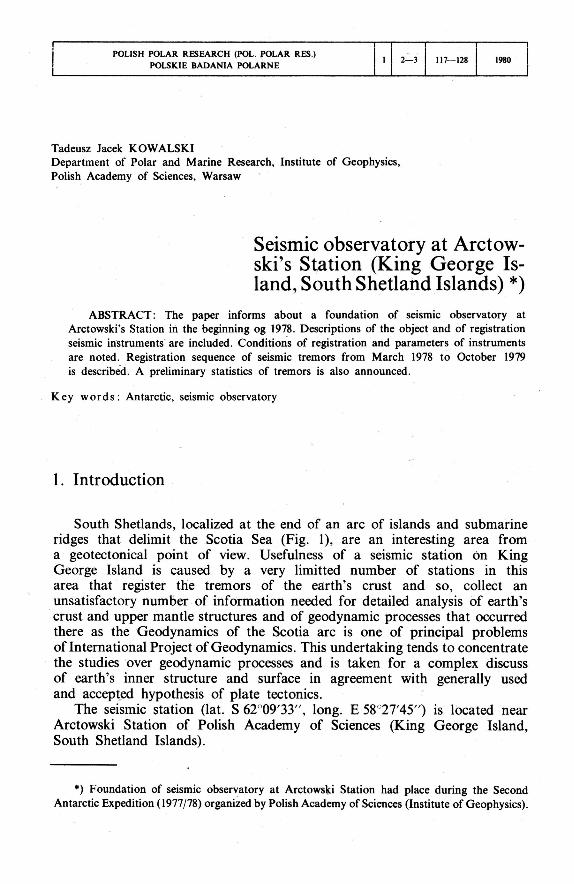
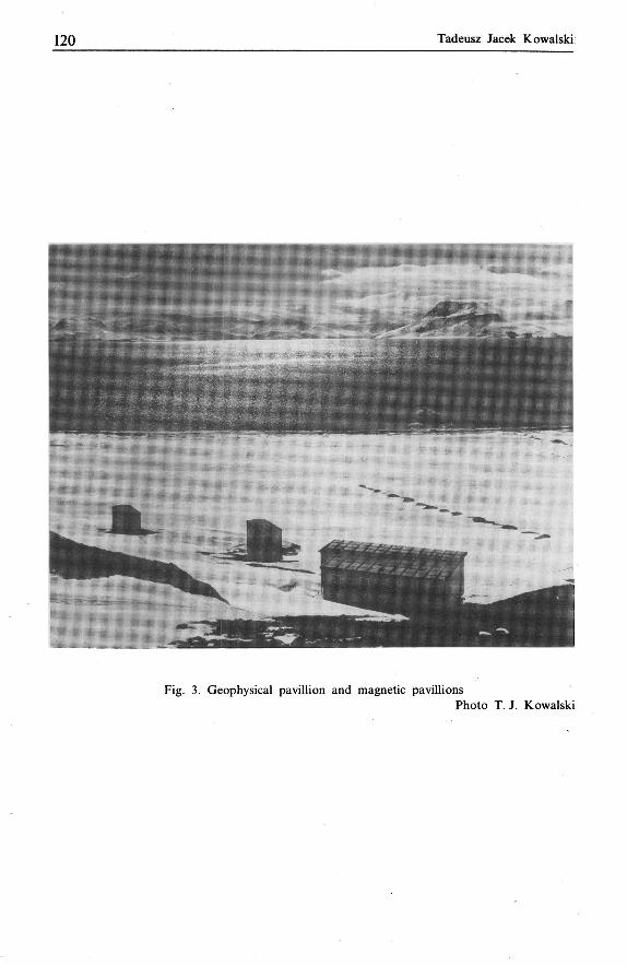
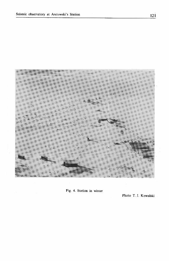
To choose the place for geophysical pavillions the conditions were taken into account that should be fulfilled simultaneously for seismic and magnetic registration. A locality aside was chosen, in a sufficient distance from other objects of the station and roads of motor vehicles that could cause the disturbances (Figs. 2, 3 and 4).
The four people started the construction works on 28th December 1977. They were in general finished on 25th February 1978 but during the final works installing and starting of seismic and magnetic instruments were carried through in the same time.
Fig. 2. Constructing of a geophysical pavillion Photo T. J. Kowalski
1 2 0 Tadeusz Jacek Kowalski
Fig. 3. Geophysical pavillion and magnetic pavillions Photo T. J. Kowalski
Seismic observatory at Arctowski's Station 121
Fig. 4. Station in winter
Photo T. J. Kowalski
122 Tadeusz Jacek Kowalski
There is a large laboratory (about 25 m-) for analyzing and interpretation of records of tremors and curves of earth magnetic field in the geophysical pavillion of about 60 m- surface. Close to the laboratory there in a pho-tographic dark chamber to be passed through to get to the room of seismic registration.
4. Seismic intruments
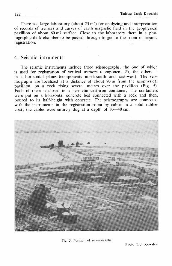
The seismic instruments include three seismographs, the one of which is used for registration of vertical tremors (component Z), the others — in a horizontal plane (components north-south and east-west). The seis-mographs are localized at a distance of about 90 m from the geophysical pavillion, on a rock rising several metres over the pavillion (Fig. 5). Each of them is closed in a hermetic cast-iron container. The containers were put on a horizontal concrete bed connected with a rock and then, poured to its half-height with concrete. The seismographs are connected with the instruments in the registration room by cables in a solid rubber coat; the cables were entirely dug at a depth of 30—40cm.
Fig. 5. Position of seismographs Photo T. J. Kowalski
Seismic observatory at Arctowski's Station 1 2 3
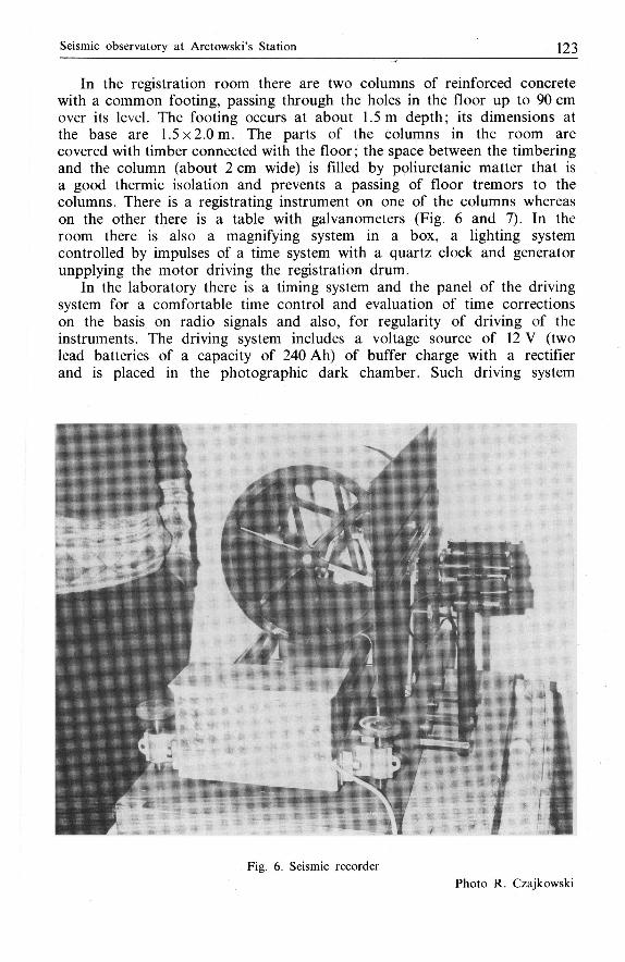
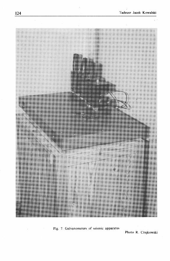
In the registration room there are two columns of reinforced concrete with a common footing, passing through the holes in the floor up to 90 cm over its level. The footing occurs at about 1.5 m depth; its dimensions at the base are 1.5 x 2.0 m. The parts of the Columns in the room are covered with timber connected with the floor; the space between the timbering and the column (about 2 cm wide) is filled by poliuretanie matter that is a good thermic isolation and prevents a passing of floor tremors to the columns. There is a registrating instrument on one of the columns whereas on the other there is a table with galvanometers (Fig. 6 and 7). In the room there is also a magnifying system in a box, a lighting system controlled by impulses of a time system with a quartz clock and generator unpplying the motor driving the registration drum.
In the laboratory there is a timing system and the panel of the driving system for a comfortable time control and evaluation of time corrections on the basis on radio signals and also, for regularity of driving of the instruments. The driving system includes a voltage source of 12 V (two lead batteries of a capacity of 240 Ah) of buffer charge with a rectifier and is placed in the photographic dark chamber. Such driving system
Fig. 6. Seismic recorder Photo R. Czajkowski
1 2 4 Tadeusz Jacek Kowalski
Fig. 7. Galvanometers of seismic apparatus Photo R. Czajkowski
Seismic observatory ot Arctowski's Station 125
guarantees a continuous registration as all the sub-assemblies of the machinery are fed with a direct current of 12 V voltage. In the case of supplying break in the mains of 220 V, a capacity of batteries would enable to feed seismic and magnetic instruments for about 48 hours. But in a period from 1st January until 20th December 1978 there occured only short (of about a second) breaks during switching over of current-generating aggregates.
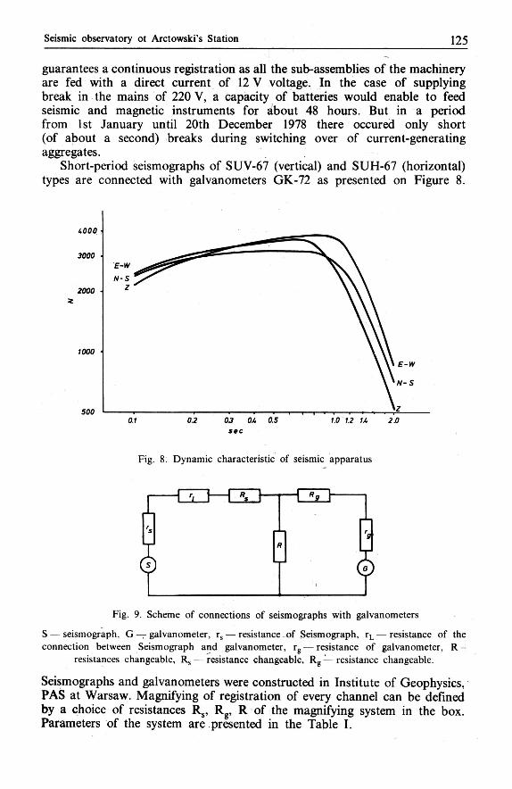
Short-period seismographs of SUV-67 (vertical) and SUH-67 (horizontal) types are connected with galvanometers GK-72 as presented on Figure 8.
sec
Fig. 8. Dynamic characteristic of seismic apparatus
Fig. 9. Scheme of connections of seismographs with galvanometers
S — seismograph. G — galvanometer, rs — resistance of Seismograph, rL — resistance of the connection between Seismograph and galvanometer, rg — resistance of galvanometer, R -
resistances changeable, R s — resistance changeable, R g — resistance changeable.
Seismographs and galvanometers were constructed in Institute of Geophysics, PAS at Warsaw. Magnifying of registration of every channel can be defined by a choice of resistances Rs, Rg, R of the magnifying system in the box. Parameters of the system are presented in the Table I.
1 2 6 Tadeusz Jacek Kowalski
T; ib le I.
Parameters of seismic instruments
Component T ł s T, D s
er2 Vo
N — S 1.18 0.34 0.50 2.01 0.002 3000 E—W 1.18 0.36 0.41 2.02 0.003 3200 Z 0.91 0.47 0.50 2.00 0.001 3200
T s — Iree period of seismometer, TV — tree period of galvanometer, D s — attenuation 01 seismometer. Dg - attenuation of galvanometer. a - — coupling coefficient, Vo — static magnification.
The tremors are registered by a galvanometric method on a photographic paper put on a rotating drum, moving at the same time along its axis. The drum is driven by a motor of alternating current 50 Hz, 12 V, produced by a quartz generator fed with a direct current of 12 V. A record velocity is 60mm/min. The time marks are realized in the following way: the lighting bulbs of galvanometers swiched off every minute for a second what results in a millimetre long break of the record. At every full hour there is a double break the later is four seconds after the former. The lighting bulbs are switched off with a use of a feeding system with regulated current intensity of every bulb and regulated break time. The system is controlled by impulses of a time system of UCRS-369-76 type, constructed in Institute of Geophysics, PAS. Time corrections are defined by comparison with readings of a quartz clock of the time system with second signals of LOL Station at Buenos Aires at an accuracy of 0.1 s. The registration of all three components is realized continuously, synchronously at the same sheet of photographic paper 30 cm wide; at the drum diameter of 30 cm and linear velocity of registration of 60 mm/min it is enough for 12 hours of work. The seismograms are developed every day and are analyzed without any delay.
Starting form 8th March 1978 the parameters of all registered tremors are transmitted every 5 day by telex to Laboratory of Seismology, Insti-tute of Geophysics. From Institute of Geophysics the parameters of selected tremors are, starting from February 1979, also transmitted by telex via Strasbourg to the American information centre — National Earthquake Information Service U.S. Geological Survey, Denver, Colorado.
All the registered tremors, recorded in perforated cards, are sent in obligatory time to International Seismologic Centre at Newbury to be published in its biulletin.
5. Registration in 1978
After starting the seismic apparatus several tests were carried through to define, first of all, the seismic noises (microseisms) the amplitude of which determined the magnification needed for registration. It is important that the amplitudes of occuring tremors were sufficiently great in relation to
Seismic observatory ot Arctowski's Station 1 2 7
amplitudes of microseisms. The latter were caused by blows of waves at the island shore. Adistinct correlation was found between state of the sea and a wind direction so — the wave orientation — and amplitude of microseisms. From 29th June until a half of September 1978 when the Admiralty Bay and sea around the island were frozen, the amplitude of microseisms has decreased much. A period of a frozen the Bay is different every year; sometimes the Bay is completely unfrozen as during the last winter season (in 1979). A maximum static magnification that is to be used in Arctowski's Station for registration cannot be greater than 3000, and the soil tremors of one micrometre amplitude are recorded as 3 mm amplitude. The seismic registration in 1978 was controlled by T. J. Kowalski. In December 1978 he was replaced by J. Speil, from Institute of Geophysics, PAS.
The following tremors were registered from 23rd March 1978 until 31st December 1978: 103 near-by tremors, 7 far-away tremors, 1 near-by and very strong tremor.
From January to October 1979: 153 near-by tremors, 16 faraway tremors, 3 near-by and very strong tremors were registered.
Among the earthquakes of 1978 the following ones were identified: 20th July 1978 —Nicaragua at 09h 34'45.2" M = 5.8 03rd August 1978 — N o r t h Chile at 18h 11'15.5"M = 6.7 05th August 1978 — South Shetland Islands at 06h 43'07.9" M = 5.6 at a distance of 202 km from Arctowski's Station.
Localization of most registered tremors will be possible after a recive of tremor parameters of other stations in West Antarctic area.
6. Summary
An initiation of seismic research works at Arctowski Station resulted from the fact that in this area — very interesting from the point of view of geodynamics — no station registering the seismic tremors occurred. Geodynamics of the Scotia Sea area including the South Shetlands is one of the most important problems of the International Geodynamics Project.
The paper describes the construction works of the geophysical laboratory (Figs. 2 and 3) and installations of its registration seismic instruments with a discussion a registration conditions. Also, the parameters of instruments and preliminary statistics of registered quakes (from March 1978 to October 1979) are cited (Figs. 5, 6, 7, 8 and 9).
7. Резюме
Открытие сейсмических исследований в Станции Арцтовского вытекает из факта, что в этом районе — очень интересном с точки зрения геодинамики — до сих пор не было станции регистрирующих сейсмические сотрясения. Геодинамика района Моря Скотия охватывающего Южные Шетланды принадлежит к начальной группе вопросов изложенных в Международном Проекте Геодинамики.
Статья описывает основание геофизической обсерватории (рис. 2 и 3), устроенную в ней сейсмическую аппаратуру, а также представляет условия регистрации. Представ-лены также параметры аппаратуры и вступительная статистика сотрясений зарегистри-рованных с марта 1978 до октября 1979 года (рис. 5, 6,' 7, 8 и 9).
128 Tadeusz Jacek Kowalski
8. Streszczenie
Zapoczątkowanie badań sejsmicznych na Stacji Arctowskiego wyniknęło z faktu, że w re-jonie tym, bardzo interesującym z punktu widzenia geodynamiki, dotychczas brak było stacji rejestrujących wstrząsy sejsmiczne. Geodynamika rejonu Morza Scotia obejmującego Południowe Szetlandy należy do czołowej grupy problemów ujętych w Międzynarodowym Projekcie Geodynamiki.
Artykuł opisuje założenie obserwatorium geofizycznego (rys. 2 i 3) oraz zainstalowanej w nim rejestracyjnej aparatury sejsmicznej wraz z podaniem warunków rejestracji. Podano także parametry aparatury i wstępną statystykę wstrząsów zarejestrowanych w okresie od marca 1978 do października 1979 roku (rys. 5, 6, 7, 8 i 9).
Paper received 14 November 1979
AUTHOR'S A D D R E S S : Mgr Tadeusz Jacek Kowalski Zakład Badań Polarnych i Morskich Instytut Geofizyki PAN Pasteura 3 02-973 Warszawa, Poland