The San DimasThe San Dimas - US Forest Service · The San Dimas Experimental Forest (SDEF) offers a...
11
Experimental Forest: A Vision The San Dimas The San Dimas U ni nite d St d Stat es D es Departmen t of t of A gr gr ic ic ul ult ur ur e F e For es es t S t Serv ic ice P P ac ac i i f f ic S ic S o o ut ut h h w w es es t Res t Res e e a a r r c c h St h St a a t t io io n n United States Department of Agriculture Forest Service Pacific Southwest Research Station PSW-MISC-78
Transcript of The San DimasThe San Dimas - US Forest Service · The San Dimas Experimental Forest (SDEF) offers a...

Experimental Forest: A VisionThe San DimasThe San Dimas
UUnini tteed Std Staa ttes Des Deeppaa rr ttmmeenn t of t of AAgrgr iciculul tturure Fe Foo rreses t St Seerr vv iciceePPacac ii ff ic Sic S oo ututhhwweses t Rest Reseeaa rrcch Sth Staa tt ioionn
United StatesDepartment ofAgriculture
Forest Service
Pacific SouthwestResearch Station
PSW-MISC-78

“Few other mountain areas of comparable size on earth havebeen as thoroughly and painstakingly examined, as has theSan Dimas Experimental Forest. There is, quite literally, noplant, no type of soil, no rock, no form of animal life that isunknown to the forest sleuths of Tanbark Flats.”
Edward Colman, forester, 1938
Cover image: San Dimas Canyon
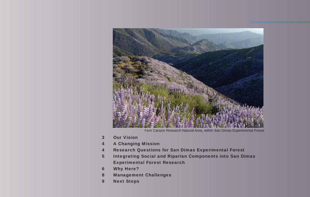
3 Our Vision
4 A Changing Mission
4 Research Questions for San Dimas Experimental Forest
5 Integrating Social and Riparian Components into San Dimas
Experimental Forest Research
6 Why Here?
8 Management Challenges
9 Next Steps
Fern Canyon Research Natural Area, within San Dimas Experimental Forest

“Wedged snugly between the lowerreaches of San Gabriel and SanAntonio canyons is a 32-squaremile rectangle of mountain countrylittle known to most southernCalifornians. Here, enclosed by loftyridges on three sides, are thewatersheds of Little Dalton, BigDalton and San Dimas Canyons, asinuous region of chaparral-coatedhills, little forested flats anddelightful creeks luxuriant with liveoak, alder, bay and sycamore. Herelies the San Dimas ExperimentalForest, an extensive outdoorlaboratory dedicated to learningabout soil, vegetation and erosion inmountain watersheds.”
John Robinson, San Gabriel Mountain historian, 1985

Our Vision
The San Dimas Experimental Forest (SDEF) offers a unique oasis of opportunity forproviding an internationally recognized wildland-urban interface research facilitywhere all land within the proclaimed boundary is used by federal, state, university, andinternational scientists to develop information and solutions for current and futureresource management questions; where outdoor education is provided on the chaparraland woodland ecosystems adjacent to the rapidly growing Los Angeles Basin; and wherelocal communities benefit from the activities at the experimental forest. We envision theSDEF as the preeminent facility for natural resource science research in Mediterranean-type ecosystems.
The SDEF is managed by the USDA Forest Service Pacific Southwest Research Station(PSW) as a field laboratory for ecosystem, watershed, and natural resource scienceresearch in chaparral and related Mediterranean-climate ecosystems. Since itsestablishment in 1933, the SDEF has been a center for hydrologic research in mountainwatersheds. This research has included intensive monitoring of precipitation and wateryield in mountainous terrain and manipulation of the natural vegetation across watershedsto maximize water yield. More recently, research has investigated the impact of wildlandfire on watershed processes and air quality and the effects of chronic air pollution fromthe Los Angeles basin on stream water quality and the biogeochemistry of nitrogen. Otherrecent experiments have studied processes and rates of soil development and erosion,patterns in plant community development, avian population dynamics, and remote sensingof fire and ecosystem processes.
Research and environmental monitoring at the SDEF have developed an extensive databaseon chaparral ecology and mountain hydrology and climate.
3

Integrating Social and Riparian Components into SDEFResearch
The SDEF is a hub for Wildland Urban Interface research studying not only the effectsof people on the landscape studied, but also the values of the landscape to people.Instead of serving as an inviolate preserve, SDEF will serve three purposes: (1) to serveas an experimental area to reconcile people’s demand for recreation and the need tomaintain functioning ecosystems, (2) to bring knowledge of the past to the needs of thefuture, and (3) to model ways to involve the various sectors of the wildland urbaninterface in land management planning.
We will study community involvement and participatory decisionmaking in planningand implementing the vision for SDEF, leading to collaborative planning models withdiverse urban communities for the urban national forests in southern California andthroughout the world. We will also study approaches for improving policy/issuecommunications with affected publics, forest interpretation, conservation education, andpostfire education to improve community understanding of forest management. Futurerecreation will study the recreation needs of urban populations and will examine publicviews on natural spaces and their management.
Small riparian areas in southern California are critical habitat for many species andhave been severely altered by human use, including recreation. We will investigatetechniques to restore riparian function in the lower reaches of the West and Main Forksof San Dimas Creek (where significant changes have occurred because of use over thepast 90 years) and investigate how riparian areas recover from the impacts of roads andrecreational residence tracts. We will implement a landscape-scale research project todetermine the appropriate use of prescribed fire to manage chaparral in a wildland-urban interface setting. The new emphases on social science and riparian restorationwill be integrated with long-term research on air pollution, water quantity, water
A Changing Mission
The current mission of the San Dimas Experimental Forest is to serve as a fieldlaboratory where scientists and managers can gain basic knowledge of physical,biological, and social science that can be applied to issues important to thesouthern California national forests and other wildlands. Through limited toursand scheduled visits, it also serves as an outdoor learning center for local youth.
In the future, research will continue on these vital issues, but we will increase ourcapacity to study integrated watershed management from the forest through the cityto the sea. Studying fire in the urban interface will be a priority focus area. Ourmission will expand to include research related to the social and recreationalcomponents of the complex southern California environment. The SDEF’s utility asa field laboratory will also be expanded to include public and school educationalopportunities, interpretive services, and environmental education curriculum.
Research Questions for SDEF
Originally, SDEF was created to answer hydrologic questions, such as how to getmore water from the watershed with management. Over time, the value of SDEFto answer a broader array of questions was recognized.
Research economists found that the costs of erosion abatement are extremelyhigh. The SDEF is ideally suited to test the hypothesis that management ofchaparral can indeed reduce sedimentation.
Fire is an integral part of ecosystem functions. The SDEF is an outdoor laboratoryto answer questions about fire ecology and fire effects, as well as restorationeffectiveness following fires. In addition to physical and biological research, SDEF is strategically located toaddress social and urban issues with research and environmental education.
4 5
Bell Canyon Tanbark Flats Browns Flats in Fern Canyon RNAHorse Saddle Canyon
Big Dalton Reservoir
Current research is confined to the green areas located above theperennial streams. Riparian areas affected by roads and therecreational residence tracts are shown in orange.
quality, chaparral ecology (plant and animal), weather, erosion and sedimentation, and postfirerehabilitation. New and refurbished federal buildings within the SDEF boundary will be used toaccomplish these activities.
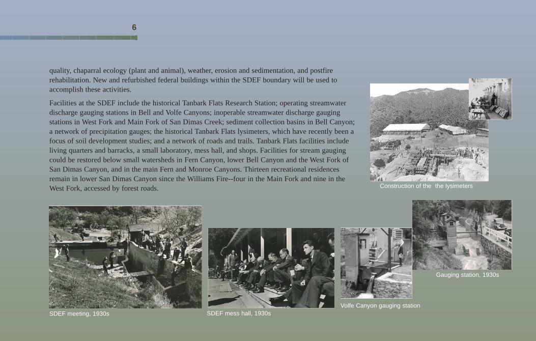
Facilities at the SDEF include the historical Tanbark Flats Research Station; operating streamwaterdischarge gauging stations in Bell and Volfe Canyons; inoperable streamwater discharge gaugingstations in West Fork and Main Fork of San Dimas Creek; sediment collection basins in Bell Canyon;a network of precipitation gauges; the historical Tanbark Flats lysimeters, which have recently been afocus of soil development studies; and a network of roads and trails. Tanbark Flats facilities includeliving quarters and barracks, a small laboratory, mess hall, and shops. Facilities for stream gaugingcould be restored below small watersheds in Fern Canyon, lower Bell Canyon and the West Fork ofSan Dimas Canyon, and in the main Fern and Monroe Canyons. Thirteen recreational residencesremain in lower San Dimas Canyon since the Williams Fire--four in the Main Fork and nine in theWest Fork, accessed by forest roads.
6
SDEF mess hall, 1930sVolfe Canyon gauging station
Construction of the the lysimeters
Gauging station, 1930s
SDEF meeting, 1930s
Why Here?
Located in the foothills of the San Gabriel Mountains, the SDEF is the largest chaparralexperimental forest in the United States. It also contains the Fern Canyon ResearchNatural Area, which is part of the Forest Service natural reserve system. The U.S. Manand the Biosphere Program has designated the SDEF as a biosphere reserve. Biospherereserves are known as “landscapes for learning” and “laboratory regions of sustainabledevelopment” because of their role in associating research and education withconservation and development issues. They provide a means for integrating conservation,research and monitoring, education and training, and involving local populations inconservation and development issues in areas of outstanding ecological, scientific, andeducational importance.
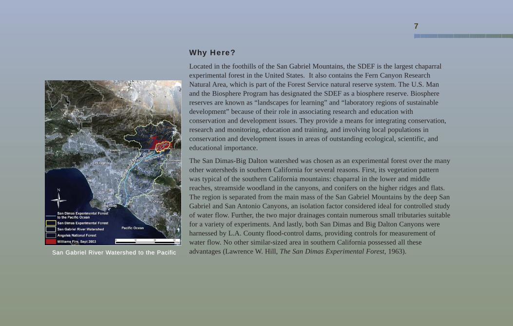
The San Dimas-Big Dalton watershed was chosen as an experimental forest over the manyother watersheds in southern California for several reasons. First, its vegetation patternwas typical of the southern California mountains: chaparral in the lower and middlereaches, streamside woodland in the canyons, and conifers on the higher ridges and flats.The region is separated from the main mass of the San Gabriel Mountains by the deep SanGabriel and San Antonio Canyons, an isolation factor considered ideal for controlled studyof water flow. Further, the two major drainages contain numerous small tributaries suitablefor a variety of experiments. And lastly, both San Dimas and Big Dalton Canyons wereharnessed by L.A. County flood-control dams, providing controls for measurement ofwater flow. No other similar-sized area in southern California possessed all theseadvantages (Lawrence W. Hill, The San Dimas Experimental Forest, 1963).
7
San Gabriel River WSan Gabriel River Watershed to the Pacificatershed to the Pacific

Management Challenges
Today the burgeoning population growth of the Los Angeles basin is placing increasing demands onnational forests for a variety of resources. Recreation use of national forests has skyrocketed, as hasthe complex interface between land covered with homes and the remaining native vegetation.Riparian areas are popular locations for many types of recreation. Shrinking areas of habitat onprivate lands mean that public lands, including national forests, are the last refuge for many rarespecies. Controversy exists over fire management in chaparral. Billions of dollars are spent to getwater into and out of the Los Angeles urban area served by the San Gabriel River system. Theseissues are increasing in importance on public lands near urban areas nationwide, with the nationalforests of southern California in the forefront.
The SDEF is uniquely situated to use innovative research approaches to address these managementchallenges through social, biological, and physical science. However, the presence of private inholdings,forest development roads, and the recreation residence tracts in the West and Main Forks of San DimasCreek significantly limit the ability to conduct needed research. The recreation residence tracts and forestdevelopment roads within and adjacent to the riparian area pre-date the establishment of theexperimental forest. Their location is not conducive to current Forest Service practice or standards, nordo they meet the vision of the experimentalforest in meeting educational and scientificneeds and demands. The tracts of land thatsupport the recreation residence are part ofthe experimental forest. The Angeles NationalForest administers the recreation residencepermits only. Today, there is increasing
8
Access to recreational residence tractswashed out by flooding within the riparian
areas, 2003-2005.
Developed area south of Big Dalton
Road wash out in San Dimas,early 1930s.
West Fork road lost toflood waters within the
riparian area.
recognition that the SDEF is unique as part of a national network of experimental forests, that itneeds a more controlled environment to utilize its full potential for a variety of researchstudies, and that to achieve that purpose it must be restored and maintained.
Next Steps
Working with our partners in local communities, other agencies, and universities, the SDEFprovides an exceptional site to:
• Better define the objectives of research in the San Dimas Experimental Forest and how that research will add to the body of knowledge about Mediterranean ecosystems gained through 70 years of data collected at the SDEF.
• Determine our role in adding benefits to local communities.• Explore the relationship between urban populations and wildland recreation areas.
• Better define the role of wildland watersheds in the integrated management of the watersupply of the greater Los Angeles Basin.
• Pursue opportunities to purchase private inholdings, discontinue use of recreation residence tracts, and decommission roads along these tracts to restore use of the land and evaluate impacts and recovery of the West and Main Forks of San Dimas Creek.
9
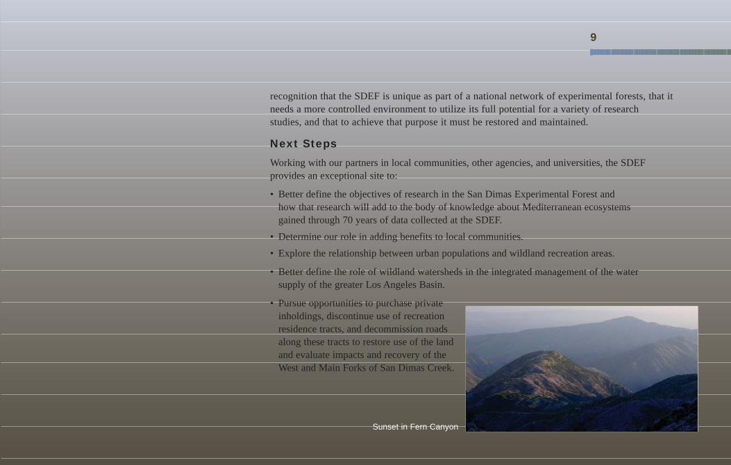
Sunset in Fern Canyon

The U.S. Department of Agriculture (USDA) prohibits discrimination in all its programs and activities on the basis of race, color, national origin, age, disability, and whereapplicable, sex, marital status, familial status, parental status, religion, sexual orientation, genetic information, political beliefs, reprisal, or because all or part of anindividual's income is derived from any public assistance program. (Not all prohibited bases apply to all programs.) Persons with disabilities who require alternativemeans for communication of program information (Braille, large print, audiotape, etc.) should contact USDA's TARGET Center at (202) 720-2600 (voice and TDD). To filea complaint of discrimination, write to USDA, Director, Office of Civil Rights, 1400 Independence Avenue, S.W., Washington, D.C. 20250-9410, or call (800) 795-3272(voice) or (202) 720-6382 (TDD). USDA is an equal opportunity provider and employer.
“Western man has often attempted to improve his environment. Nowhere is this more evident than in the workof the San Dimas Experimental Forest. This extensive outdoor library, dedicated to learning about the influencesof geology, soil and vegetation on mountain watersheds occupies almost all of the San Dimas and Big Daltonwatersheds. The knowledge gained in almost a half century of forest research has benefited not only southernCalifornia but the whole world.”
John Robinson, San Gabriel Mountain historian, 1985
www.fs.fed.us/psw/ef